Highlights
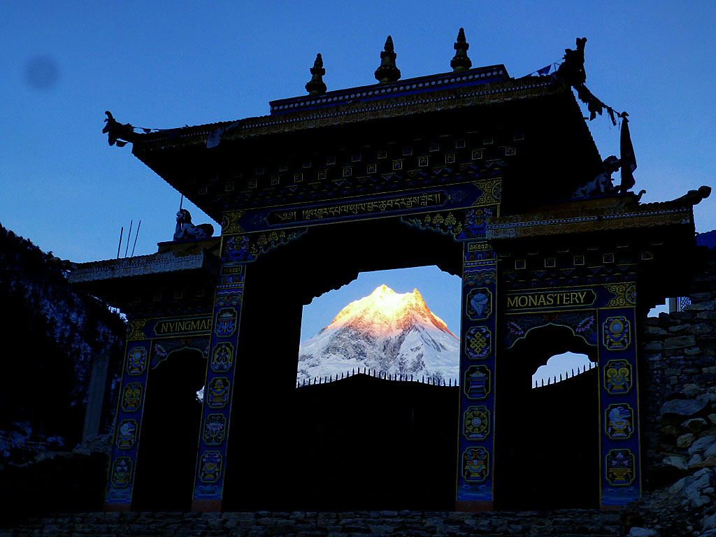
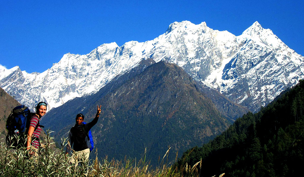
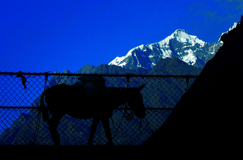
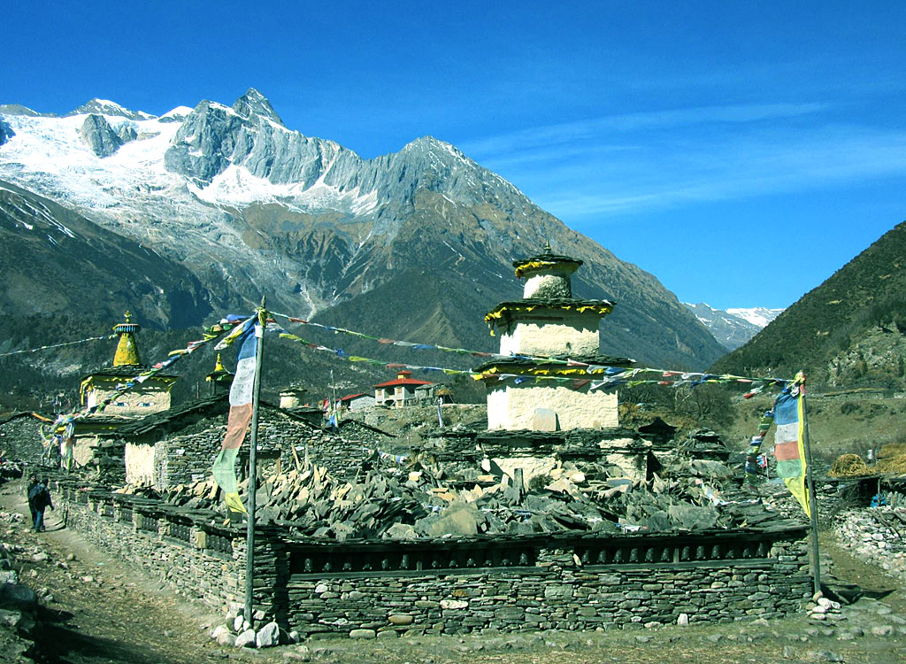
Manaslu circuit trek starts from drive from Kathmandu to Arughat. As the road is muddy and off road, drive to Arughat is bumpy. From Arughat, trail follows through the upstream of Budi Gandaki River. For the first few days, you will pass through sub-tropical forest with different kind of vegetation like rhododendron, oak, pine, juniper, spruce, and wildlife like musk deer, monkeys, blue sheep, black bear, snow leopard, marmot, wild catetc. Then as you gain altitude, you will trek along the dry deserted trail. View of the mountains like Manaslu, Himlung, Larkey Peak, Annapurna II, and many other small and big mountains will accompany you throughout the trek. Trail passes through different villages like Jagat, Ghap, Lho, Sama Gaun, Samdo, Dharmasala, Larkey Pass, Bhimtang, Kharche, Dharapani, and then drive to Besisahar. During this trek, you will see different community people, mostly influenced by Buddhist religion. Monasteries, prayer wheels, Mani walls, prayer flags can be seen throughout the trek. Numerous waterfalls, glaciers, and snow capped peaks can be seen during this trek. If you have extra time, you can also opt to trek around Tsum valley. If not, you can complete this trek in 18-19 days with some extra days for acclimatization. During the recent year, this Manaslu circuit is gaining popularity and more trekkers are opting this trek apart from Annapurna Base Camp or Everest Base Camp as these trekking routes are highly touristic and more crowded during the peak season.
As this is a restricted trekking area, you will require at least two people for trekking and a guide is mandatory. Trekking solo is prohibited in Manaslu region. You will also need a special permit to trek this region. During this trek, you will see chance in landscapes, vegetation and the lifestyle of the people. You will be gaining an altitude of 5200 m approximately during this trek. The lowest altitude will be 600 m. Due to this change in altitude, this trek is little difficult and strenuous compared to Annapurna, Langtang, or Everest trek. There are few places where you need to be careful while walking the narrow trail as there is a chance of landslide and rock fall. So, one must be careful while walking in this trail.
Itenary
Duration: 16 Nights / 17 Days
Max Altitude: 5155 m
Difficulty: Hard
Cost: $1050.00 Per person
Country: Nepal
Activity: Bird Watching, Day Trips, Explore Nepal, Peak Climbing, Tour, Trekking
Starting Point: Kathmandu
Ending Point: Kathmandu
-
Day 01: Arrive at Kathamandu 1350m Transfer to Hotel:
Welcome to Kathmandu, the capital city of the Himalayan kingdom of Nepal. You will be met on airport and transferred to your hotel. After the arrival, the group will be formally introduced to Guide for the activities over the next few days. One should pay attention in particular to the safety aspects of the briefing. Any questions or doubts should be asked and clarified at this time. We check your insurance details and other requirement for your trekking.
-
Day 02: Manaslu permit arrangement & Kathmandu sightseeing
Today we will make Manaslu Special permit as well as arrange the all needed document for this trek. In the late afternoon we can sort out any equipment that you need to rent as well as meet with guide & short brief about trekking & for you that After breakfast, we start an interesting tour around Kathmandu. Escorting by an English speaking guide be, try to give them a full taste of our vivid culture image and an enchanting manner of its people. In our sightseeing tour we go to Monkey temple Swayambhunath, Pashupatinath and Kathmandu Durbar square. Durbar Square: -This complex of palaces, courtyards and temples, built between the 12th and 18th centuries, used to be the seat of the ancient Malla kings of Kathmandu. An intriguing piece here is the 17th century stone inscription set into the wall of the palace with writings in 15 languages. The Durbar square, protected as an UNESCO world Heritage site, is the social, religious and urban focal point of the city. There are also museums inside the palace building. There is an entrance fee of Rs.250 for foreign visitors. Your ticket to the Square entitles you to visit all the museums. Swayambhunath, 6.5 kilometers west of Kathmandu, situated on a hillock, this 2000 years old Stupa is the world’s most glorious Buddhist shrine and is surrounded by several small pagodas. The main temple is capped by a pinnacle of copper gilt and is painted on the four sides with all seeing eyes of Lord Buddha. Pashupatinath, dedicated to Lord Shiva, is the holiest and most famous Nepalese temple. Situated 5 kilometers northeast of Kathmandu on the bank of the sacred Bagmati River, it is an impressive pagoda style structure with gilt roof and richly carved silver doors. It has bathing and cremation ghats, which are of absorbing interest to the tourist, particularly in the mornings and on festival days.
-
Day 03: Kathmandu to Arughat (6hrs/ 608 m) then Trek to Sotii Khola (700m/3hrs
We take a private bus for the drive (around 6 hours) to the hill bazaar town of Arughat. Clustered on both sides of the river, and linked by a suspension bridge, this is the largest settlement in the Valley then continue walk to Soti Khola.We now head north, following the Buri Gandaki. In the low country we are surrounded by rice paddies and picturesque hamlets. After climbing briefly to Kyoropani, we descend once again to the river and our campsite at the confluence with the tributary of Sundi Khola. It is not a long day, and perhaps we have time for a refreshing swim sometime during the day for it is hot in the lowcountry.
-
Day 04: Soti Khola to Machha Khola (870m/5hrs)
The country changes, the broad valley narrows and at times the trail is cut into the steep valley side, which is densely forested. We pass a number of small villages, tucked into the hillside, until we reach a widening of the valley, opposite the point where a large tributary stream enters the Buri Gandaki. The terraced farmland here belongs to the village of Lapubesi. We descend once again to the wide, sandy riverbed and follow a path, which runs below the steep, craggy valley side. At length, we have to climb up once again on a trail to Machha Khola. We camp outside the village, which has a number of tea shops.
-
Day 05: Machha Khola to Jagat (1340m/5.5hrs)
We cross the Machha Khola – Fish Stream – and head upstream to the tiny village of Khola Bensi and the hot springs at Tatopani (which I want to investigate). The valley sides steepen until they are impassable and the route then switches to the left bank by way of a suspension bridge. The trail is quite exposed and challenging in places. After a short section of forest path we reach the single tea-house at Doban. Above Doban, the Buri Gandaki descends an impressive series of rapids. Beyond this steep section, the river is much more placid, meandering across a broad gravel bed. At Lauri, we recross the river on a suspension bridge and then climb on a high path to the fields of Jagat, where we camp.
-
Day 06: Jagat to Deng (1860m/5.30hrs)
After descending a long series of stone steps to the river, we climb a terraced hill to Saguleri, from where we can see the impressive Sringi Himal, 7187m. Crossing the river again, at Gata Khola, the path splits, with the right-hand branch heading off towards the Ganesh Himal. Our route continues upstream, through a gorge section with towering walls. We cross the river three more times in the next two hours to avoid difficult valley sides and then climb up over a further steep spur to reach the village of Deng (four houses), where we camp. Today is a longer day of around 7 hours trekking.
-
Day 07: Deng to Namrung (2630m/5 hrs)
The valley is still steep-sided and most impressive. We cross to the village of Lana, and start to see mani stones (prayers etched onto wayside rocks), a sure signs that we are entering high country Buddhist regions. After only about four hours we reach our camping place at the village of Ghap, which straddles the river & we are going to take lunch here the after finish our lunch we will continue to Namrung for overnight.. We gain altitude to take us into alpine territory and increasing mountain views. There are more mani walls and 3 more crossing of the Budi Gandaki on our route to Lho. Above this village the valley opens out and there are extensive pastures. Climbing climb gently now, and cross a large stream flowing down from the Lidanda Glaciers, and reach the Tibetan village of Sho, 3000m. We camp just above the village we get our first incredible views of the Manaslu North and then of Manaslu main ahead
-
Day 08: Namrung to Lho (3180m/5hrs)
Let the exploring start! We will discuss with locals what our best option is to get to the gompa. Our sherpas reckon it could be a very nice walk to take the smaller direct trail… We pass thru Lho, a large village at 3150 metres where there is a lovely little monastery and numerous chortens and manis. Looking back Ganesh I is visible. Leaving the village, we follow the right bank of the river, with views of Peak 29 ahead. At a fork in the trail, we take a detour to the left, which leads up to Honsansho Gompa and the Pungen Glaciers, from where there is a stunning view of Peak 29 and Manaslu. We will camp somewhere around here and explore and acclimatise for the next few days.
-
Day 09: Lho to Samagaon (3520m/5hrs)
Descending to the main trail via a direct route, we soon reach the fields of Sama Gaon, 3500m. We camp at Sama Gompa, 20 minutes beyond the village, or Samdo, near the Tibetan border
-
Day 10: Rest day at Samagaon for acclimatization:
Surrounded by mountains in a peaceful forest, we take a rest day to acclimatize and relax. It is a good time to catch up on that book or wash clothes. If you want to go around then you will bring to Glacier Lake above the place which is an amazing to visit during this trekking
-
Day 11: Samagaon to Samdo (3875m/5hrs
After breakfast that we start our walking of day 11. It takes 5.30hrs. to Samdo. Now that we are more used to the altitude we take some time to have a good look around. We may camp higher in the valley.
-
Day 12: Samdo to Dharmasala (4460m/5hrs)
The once large Budhi Gandaki is now merely a stream as we continue to follow its course ever upwards. Everywhere you look are mountains, as spectacular as they get and Manaslu is particularly impressive. After crossing to the East bank of the river, we reach the last permanent settlement in the valley which is called Sumdu. Above the village we cross the stream which runs down from the Gya La (Pass), the pass to Tibet, and there is the ruins of another village here known as Larkya Bazaar. Presumably this village thrived on trade with Tibet over the nearby Gya La, a trade which is now much diminished. Nearing the Larkya Glacier, we reach a lodge at 4450m which has been built to serve the travelers crossing the Larkya La.
-
Day 13: Dharmasala to Cross the 5135m Larkya La and trek to Bhimthang (3990m/7.5hrs)
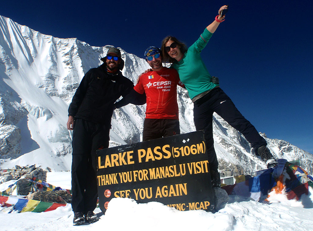
After a short climb above the lodge, we reach the ablation valley on the North side of the Larkya Glaciers. There are views of Cho Danda and then of Larkya Peak. Finally, we walk across the moraines of the glacier, making a gradual ascent which becomes steeper only in the last section to the Larkya-La pass 5135m. From the pass, there are outstanding views of Himlung Himal, Cheo Himal, Kangguru and the huge Annapurna II. Initially, there is a steep descent over snow and then screen, to reach the ablation valley trail to Larcia Kharka. A further hour on a moraine ridge path leads to Bhimthang 3900m in pleasant forest.
-
Day 14: Bhimthang to Goa (2515m/5hrs)
Below us is Bimthang, a broad and level ablation valley with a number of mani walls and deserted houses. Crossing this high pasture, we descend the valley of the Burdin Khola to the area of the Base Camp for the West side of Manaslu. From a ridge at 4150 metres, we have excellent views of Manaslu to the South East and Annapurna II to the South West. Beyond a bridge over the headwaters of the Dudh Khola, we descend into a rhododendron forests and follow a trail through a narrow valley until we reach the highest cultivated land in this valley at Goa.
-
Day 15: Goa to Trek to Dharapani or Tal (1700m/5.30hrs)
We climb through terraced fields to the Karche La (Pass), and can see ahead a green and heavily forested valley, dropping down to the distant Marshyangdi river. At Thonje village is our final restricted area checkpost. Here we cross the Marsyandi River and join the main Annapurna Circuit, and the hoards of trekkers.
-
Day 16: Drive to Besishahar by local jeep & back to Kathmandu by car
Today after breakfast we will take jeep from Dhara Pani then drive till Besisahar then drive to Kathmandu by private car. it takes 6 hours drive to Kathmandu .
In the Evening we will drive you to fare well Dinner in Nepali cultural restaurant.
-
Day 17: International Departure
All too soon it’s time to bid Nepal farewell and one realizes that we can never be intimate, only acquainted with this amazing adventure kingdom.
Tour Accomodation
What's Included
- Arrival/Departure
Transfers as per itinerary.
- Transportation
Kathmandu/Arughat and Besisahar /Kathmandu transportation in local bus.
- Accommodation
Twin sharing accommodation in Kathmandu hotel with breakfast as per itinerary.
- Permits
All necessary permits during sightseeing and trekking.
- Guide/Porter
Fully escorted trek with English speaking guide. One porter between two person.
- Wages
Wages, equipment, insurance and other facilities to staffs. Accommodation, Meals, Salary, equipment, transportation and insurance for trekking staff.
- Meals/Accommodation
All 3 meals and accommodation while on the trek.
- Rescue arrangements
Travel and rescue arrangement & All government taxes
- First Aid Kits
Madical kit
- Farewell dinner
in Nepali traditional restaurant
- International Ticket reconfirmation.
checking flight time
- Maps
Manaslu Trekking map for group
- Certificate
Trip Success Certificate
- International Airfare
- Visa Fee
Nepal Visa fee (US$ 40 per person)
- Permits
Special restricted permit from Sept. to Nov. US$ 70 per week per person. From Dec. to Aug. US$ 50 per week per person.
- Travel Insurance
Travel Insurance (this is a mandatory condition of booking).
- Emergency Evacuation
Medical evacuation in case of emergency.
- Personal expenses
Personal spending money. Items of personal nature i.e. Soft/hard drinks, tips etc.
- Unforeseen Expenses
Expenses incurred due to mishaps, landslide, strikes, political unrest etc. In such case extra will be charged as per actual.
- Tip
Tip for staffs
Availability
| Start | End | Status | Price |

